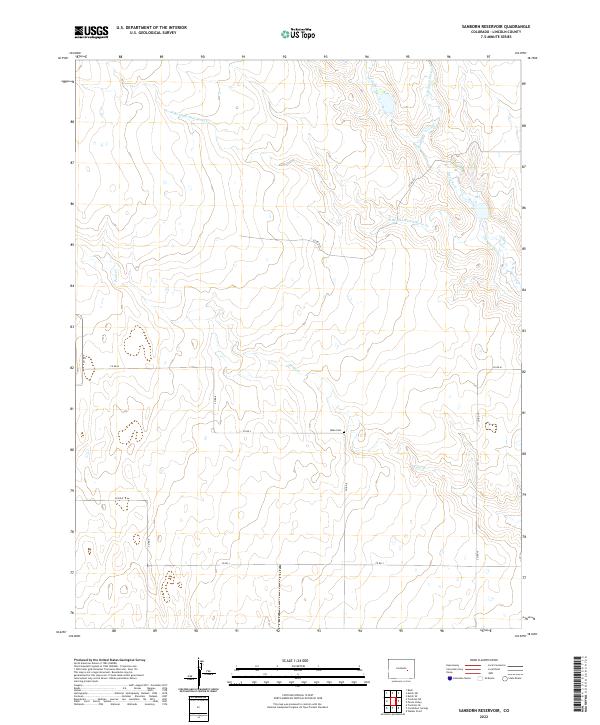
2022 Map of Sanborn Reservoir
USGS Topo · Published 2022About this map
Rube Cem stands as a lonely landmark in this high plains landscape of Lincoln County, situated near the intersection of Co Rd L and Co Rd 8. The terrain is defined by a dendritic network of seasonal drainages, including Pond Creek and the headwaters of W Br Steels Fork Horse Cr. Human activity in the region is traced through a grid of rural routes such as Co Rd M and Co Rd K, reflecting the systematic township and range organization of the American West. The presence of the Douglas Ditch in the eastern portion of the map suggests the critical importance of water management and irrigation in this arid environment. This 2022 survey illustrates a sparsely populated ranching or agricultural area where traditional land divisions remain the primary structural element of the landscape.
Find a feature on this map
20 named features on this map. Tap any name to fly to it.
Don’t see what you’re looking for? This feature index may not catch every label — zoom into the map to look around manually.
Map Details
Editions of this 2022 Sanborn Reservoir Map
This is the sole edition of this map. No revisions or reprints were ever made.
Other maps of this area

1889 · Sanborn
USGS Topo · 1:125,000

1891 · Sanborn
USGS Topo · 1:125,000

1893 · Sanborn
USGS Topo · 1:125,000

1893 · Big Springs
USGS Topo · 1:125,000

1954 · Lamar
USGS Topo · 1:250,000

1954 · Pueblo
USGS Topo · 1:250,000

1957 · Pueblo
USGS Topo · 1:250,000

1958 · Pueblo
USGS Topo · 1:250,000

1958 · Lamar
USGS Topo · 1:250,000

1962 · Pueblo
USGS Topo · 1:250,000