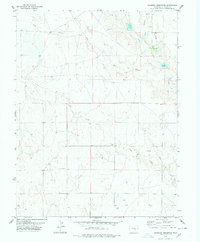
1978 Map of Sanborn Reservoir
USGS Topo · Published 1978About this map
Rube Cemetery stands as a quiet focal point in this high plains landscape of Lincoln County, documenting the rural character of the region in the late 1970s. The map illustrates a complex water management system essential for agriculture and ranching, featuring the Sanborn Reservoir, Douglas Reservoir, and the connecting Douglas Ditch. Drainage is defined by the convergence of the West Branch Steels Fork and East Branch Steels Fork into the main channel of Steels Fork. A solitary Landing Strip and a modern Pipeline cut across the sections, indicating the integration of localized infrastructure into the expansive prairie. This survey provides a precise view of a working landscape where natural features like Pond Creek are modified by human engineering to sustain the local economy.
Find a feature on this map
18 named features on this map. Tap any name to fly to it.
Don’t see what you’re looking for? This feature index may not catch every label — zoom into the map to look around manually.
Map Details
Editions of this 1978 Sanborn Reservoir Map
This is the sole edition of this map. No revisions or reprints were ever made.
Other maps of this area

1889 · Sanborn
USGS Topo · 1:125,000

1891 · Sanborn
USGS Topo · 1:125,000

1893 · Sanborn
USGS Topo · 1:125,000

1893 · Big Springs
USGS Topo · 1:125,000

1954 · Lamar
USGS Topo · 1:250,000

1954 · Pueblo
USGS Topo · 1:250,000

1957 · Pueblo
USGS Topo · 1:250,000

1958 · Pueblo
USGS Topo · 1:250,000

1958 · Lamar
USGS Topo · 1:250,000

1962 · Pueblo
USGS Topo · 1:250,000