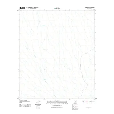
2011 Map of Sand Wells
USGS Topo · Published 2011About this map
Ko Vaya Wash carves a branching path across this arid landscape in the Gu Achi District of Pima County, shaping the drainage patterns for the surrounding desert. The terrain is defined by the prominent rise of Black Mountain, providing a distinct landmark for navigation in an otherwise open area. This 2011 survey captures a landscape focused on seasonal water management, as evidenced by the presence of cattle tanks and catchment basins such as Standing Bar Tank and Pad Wo'o Tank. These features suggest a continued reliance on traditional ranching and water-retention methods in this part of Arizona. Transport through the region is anchored by Indian Rte 34, which provides a vital link across the desert floor.
Find a feature on this map
5 named features on this map. Tap any name to fly to it.
Don’t see what you’re looking for? This feature index may not catch every label — zoom into the map to look around manually.
Map Details
Editions of this 2011 Sand Wells Map
This is the sole edition of this map. No revisions or reprints were ever made.
Other maps of this area

1934 · Silver Bell
USGS Topo · 1:125,000

1937 · Comobabi
USGS Topo · 1:48,000

1942 · Comobabi
USGS Topo · 1:62,500

1953 · Ajo
USGS Topo · 1:250,000

1956 · Tucson
USGS Topo · 1:250,000

1957 · Ajo
USGS Topo · 1:250,000

1958 · Ajo
USGS Topo · 1:250,000

1958 · Tucson
USGS Topo · 1:250,000

1959 · Tucson
USGS Topo · 1:250,000

1962 · Ajo
USGS Topo · 1:250,000