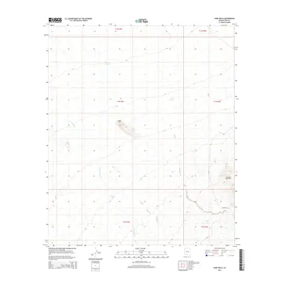
2014 Map of Sand Wells
USGS Topo · Published 2014About this map
Sand Wells serves as a central point of reference in this arid landscape, located along the eastern edge of the survey area where the terrain begins to rise into the Comobari Mountains. This 2014 representation of the Gu Achi District illustrates a desert environment defined by ephemeral water management and isolated geological landmarks. The presence of Standing Bar Tank and Pad Wo'o Tank underscores the importance of seasonal water catchments in Pima County, while the seasonal course of Ko Vaya Wash cuts through the desert floor. To the northwest, the distinct elevation of Black Mtn provides a sharp contrast to the surrounding flats. Infrastructure is limited to the winding path of Bia-33, a Bureau of Indian Affairs route that connects these remote features across the Tohono O'odham Nation.
Find a feature on this map
13 named features on this map. Tap any name to fly to it.
Don’t see what you’re looking for? This feature index may not catch every label — zoom into the map to look around manually.
Map Details
Editions of this 2014 Sand Wells Map
This is the sole edition of this map. No revisions or reprints were ever made.
Other maps of this area

1934 · Silver Bell
USGS Topo · 1:125,000

1937 · Comobabi
USGS Topo · 1:48,000

1942 · Comobabi
USGS Topo · 1:62,500

1953 · Ajo
USGS Topo · 1:250,000

1956 · Tucson
USGS Topo · 1:250,000

1957 · Ajo
USGS Topo · 1:250,000

1958 · Ajo
USGS Topo · 1:250,000

1958 · Tucson
USGS Topo · 1:250,000

1959 · Tucson
USGS Topo · 1:250,000

1962 · Ajo
USGS Topo · 1:250,000