2024 Map of Sandersville
USGS Topo · Published 2024About this map
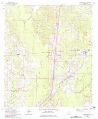
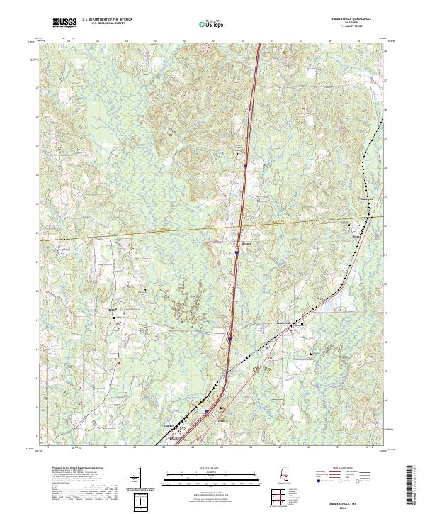
Sandersville and the surrounding pine-belt landscape of Jones County and Jasper County are defined by a network of rural settlements and family-named landmarks. The terrain is deeply carved by drainage systems like Tallahala Creek and the bifurcated Reedy Creek, which shape the local geography and road placement. For genealogists, the map is particularly useful for its documentation of numerous small burial grounds, ranging from church-affiliated sites like Corinth Baptist Church Cem to smaller family plots such as the May Cem and McGill Cem. The settlement at Sharon is noted with multiple distinct sites including the Old Sharon Cem and Sharon Cem, suggesting a long-standing community center. Smaller crossroads and rail-adjacent points like Bonner, Haney, and Errata provide a detailed look at the scattered residential nodes that persist in this part of Mississippi.
Find a feature on this map
115 named features on this map. Tap any name to fly to it.
Don’t see what you’re looking for? This feature index may not catch every label — zoom into the map to look around manually.
Map Details
Editions of this 2024 Sandersville Map
This is the sole edition of this map. No revisions or reprints were ever made.