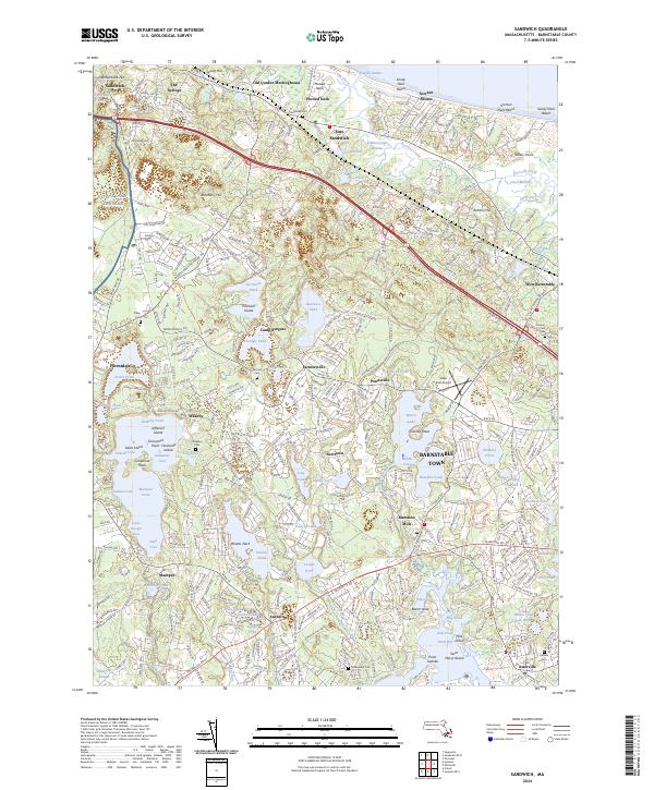
2024 Map of Sandwich
USGS Topo · Published 2024About this map
The Old Quaker Meetinghouse stands as a testament to the early religious settlement of this coastal region, situated amidst a landscape defined by glacial ponds and saltwater marshes. This survey of the Barnstable Town area reveals a dense network of water bodies, from the expansive Wakeby Pond and Mashpee Pond to the intricate tidal networks of the Scorton Creek Marshes. The terrain is marked by distinctive features like the Sandy Neck Dunes and family-named elevations such as Elephantback Hill and Scorton Hill.
Find a feature on this map
107 named features on this map. Tap any name to fly to it.
Don’t see what you’re looking for? This feature index may not catch every label — zoom into the map to look around manually.
Map Details
Editions of this 2024 Sandwich Map
This is the sole edition of this map. No revisions or reprints were ever made.
Other maps of this area

1886 · Falmouth
USGS Topo · 1:62,500

1886 · Plymouth
USGS Topo · 1:62,500

1888 · Barnstable
USGS Topo · 1:62,500

1888 · Falmouth
USGS Topo · 1:62,500

1889 · Plymouth
USGS Topo · 1:62,500

1893 · Barnstable
USGS Topo · 1:62,500

1893 · Falmouth
USGS Topo · 1:62,500

1894 · Plymouth
USGS Topo · 1:62,500

1915 · Falmouth
USGS Topo · 1:62,500

1920 · Falmouth
USGS Topo · 1:62,500