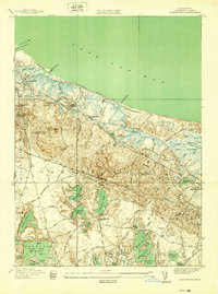
1939 Map of Sandwich
USGS Topo · Published 1939About this map
Sandwich and the surrounding Barnstable County landscape are defined by a complex coastal network of salt marshes and freshwater kettle ponds just before the Second World War. The shoreline is punctuated by Sandwich Harbor and the Cape Cod Canal, with the Scorton Great Marshes stretching east toward West Barnstable. Inland, the terrain rises toward heights like Telegraph Hill Fire Tower and Discovery Hill, overlooking a series of large water bodies including Peters Pond, Wakeby Pond, and Lawrence Pond.
Find a feature on this map
80 named features on this map. Tap any name to fly to it.
Don’t see what you’re looking for? This feature index may not catch every label — zoom into the map to look around manually.
Map Details
Editions of this 1939 Sandwich Map
This is the sole edition of this map. No revisions or reprints were ever made.
Other maps of this area

1886 · Falmouth
USGS Topo · 1:62,500

1886 · Plymouth
USGS Topo · 1:62,500

1888 · Barnstable
USGS Topo · 1:62,500

1888 · Falmouth
USGS Topo · 1:62,500

1889 · Plymouth
USGS Topo · 1:62,500

1893 · Barnstable
USGS Topo · 1:62,500

1893 · Falmouth
USGS Topo · 1:62,500

1894 · Plymouth
USGS Topo · 1:62,500

1915 · Falmouth
USGS Topo · 1:62,500

1920 · Falmouth
USGS Topo · 1:62,500