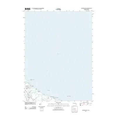
2012 Map of Sandwich OE N
USGS Topo · Published 2012About this map
Town Neck and the surrounding coastal landscape are defined by the meeting of the Atlantic Ocean and the marshy inlets of Sandwich Harbor. This coastal survey highlights the intricate network of tidal waterways, including Old Harbor Cr and Springhill Brook, which shape the local geography south of the Cape Cod Canal Breakwater Light. The residential character of the era is evident in the dense street grid near Town Neck Hill, featuring local thoroughfares like Town Neck Rd and Dillingham Ave. Inland, the map documents specialized land use such as the Massachusetts State Fish Hatchery near Shawme Lake and the Mount Hope Cem, providing a detailed record of the community's infrastructure and natural resources during the early 21st century.
Find a feature on this map
32 named features on this map. Tap any name to fly to it.
Don’t see what you’re looking for? This feature index may not catch every label — zoom into the map to look around manually.
Map Details
Editions of this 2012 Sandwich OE N Map
This is the sole edition of this map. No revisions or reprints were ever made.
Other maps of this area

1886 · Falmouth
USGS Topo · 1:62,500

1886 · Plymouth
USGS Topo · 1:62,500

1888 · Barnstable
USGS Topo · 1:62,500

1888 · Falmouth
USGS Topo · 1:62,500

1889 · Plymouth
USGS Topo · 1:62,500

1893 · Barnstable
USGS Topo · 1:62,500

1893 · Falmouth
USGS Topo · 1:62,500

1894 · Plymouth
USGS Topo · 1:62,500

1915 · Falmouth
USGS Topo · 1:62,500

1920 · Falmouth
USGS Topo · 1:62,500