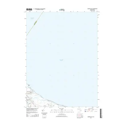
2015 Map of Sandwich OE N
USGS Topo · Published 2015About this map
Sandwich sits at the edge of the Atlantic Ocean in this 2015 survey, where the terrestrial landscape meets the complex tidal hydrology of the Massachusetts coast. The map captures the coastal interface at the northern end of the Cape, highlighting the vital Intracoastal Waterway and the protective barrier formed by Town Neck Rd. Inland, the freshwater environment of Shawme Lake transitions into a network of salt marshes and tidal channels, including Old Harbor Creek, Dock Creek, and Mill Creek. This specific alignment of roads like North Shore Blvd and Salt Marsh Rd against the shoreline illustrates the modern residential development pattern built directly upon the delicate marshy lowlands and coastal dunes of the region.
Find a feature on this map
30 named features on this map. Tap any name to fly to it.
Don’t see what you’re looking for? This feature index may not catch every label — zoom into the map to look around manually.
Map Details
Editions of this 2015 Sandwich OE N Map
This is the sole edition of this map. No revisions or reprints were ever made.
Other maps of this area

1886 · Falmouth
USGS Topo · 1:62,500

1886 · Plymouth
USGS Topo · 1:62,500

1888 · Barnstable
USGS Topo · 1:62,500

1888 · Falmouth
USGS Topo · 1:62,500

1889 · Plymouth
USGS Topo · 1:62,500

1893 · Barnstable
USGS Topo · 1:62,500

1893 · Falmouth
USGS Topo · 1:62,500

1894 · Plymouth
USGS Topo · 1:62,500

1915 · Falmouth
USGS Topo · 1:62,500

1920 · Falmouth
USGS Topo · 1:62,500