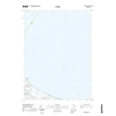
2021 Map of Sandwich OE N
USGS Topo · Published 2021About this map
Sandwich anchors the shoreline on this coastal survey, where the intricate drainage of Sandwich Harbor Marshes meets the open water of the Atlantic. The landscape is defined by the tidal interface of Old Harbor Creek, Mill Creek, and Springhill Creek, which snake through the wetlands south of Scusset Beach. Human history is clearly marked by the dense residential grid of the town center and the prominent Mount Hope Cem situated near the intersection of Charles St and Ox Pasture Rd.
Find a feature on this map
31 named features on this map. Tap any name to fly to it.
Don’t see what you’re looking for? This feature index may not catch every label — zoom into the map to look around manually.
Map Details
Editions of this 2021 Sandwich OE N Map
This is the sole edition of this map. No revisions or reprints were ever made.
Other maps of this area

1886 · Falmouth
USGS Topo · 1:62,500

1886 · Plymouth
USGS Topo · 1:62,500

1888 · Barnstable
USGS Topo · 1:62,500

1888 · Falmouth
USGS Topo · 1:62,500

1889 · Plymouth
USGS Topo · 1:62,500

1893 · Barnstable
USGS Topo · 1:62,500

1893 · Falmouth
USGS Topo · 1:62,500

1894 · Plymouth
USGS Topo · 1:62,500

1915 · Falmouth
USGS Topo · 1:62,500

1920 · Falmouth
USGS Topo · 1:62,500