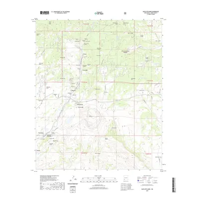
2020 Map of Santa Rita Mine
USGS Topo · Published 2020About this map
The Santa Rita Mine anchors this industrial landscape in Grant County, where the high-elevation terrain of the Pinos Altos Range meets the intense activity of New Mexico’s mining history. The map details a dense corridor of settlements and technical sites, including Hanover, Fierro, and Vanadium, which emerged to support the region’s mineral extraction. Subterranean infrastructure is well-documented through labels for the Gilchrist Tunnel, Snowflake Tunnel, and the Union Hill Portal, reflecting the area's geological importance. The transition from industrial zones to the protected wilderness of the Gila National Forest is clear, as canyons like Georgetown Canyon and Shingle Canyon cut through the rugged uplands. Numerous family and community landmarks, such as Georgetown Cem and the distinctive Kneeling Nun rock formation, provide essential points of reference for local historians and genealogists.
Find a feature on this map
88 named features on this map. Tap any name to fly to it.
Don’t see what you’re looking for? This feature index may not catch every label — zoom into the map to look around manually.
Map Details
Editions of this 2020 Santa Rita Mine Map
This is the sole edition of this map. No revisions or reprints were ever made.
Other maps of this area

1909 · Silver City
USGS Topo · 1:125,000

1937 · Santa Rita
USGS Topo · 1:24,000

1947 · Allie Canyon
USGS Topo · 1:24,000

1947 · Twin Sisters
USGS Topo · 1:24,000

1947 · Fort Bayard
USGS Topo · 1:24,000

1948 · Twin Sisters
USGS Topo · 1:24,000

1948 · Santa Rita
USGS Topo · 1:24,000

1948 · Allie Canyon
USGS Topo · 1:24,000

1948 · Hurley East
USGS Topo · 1:24,000

1949 · Fort Bayard
USGS Topo · 1:24,000