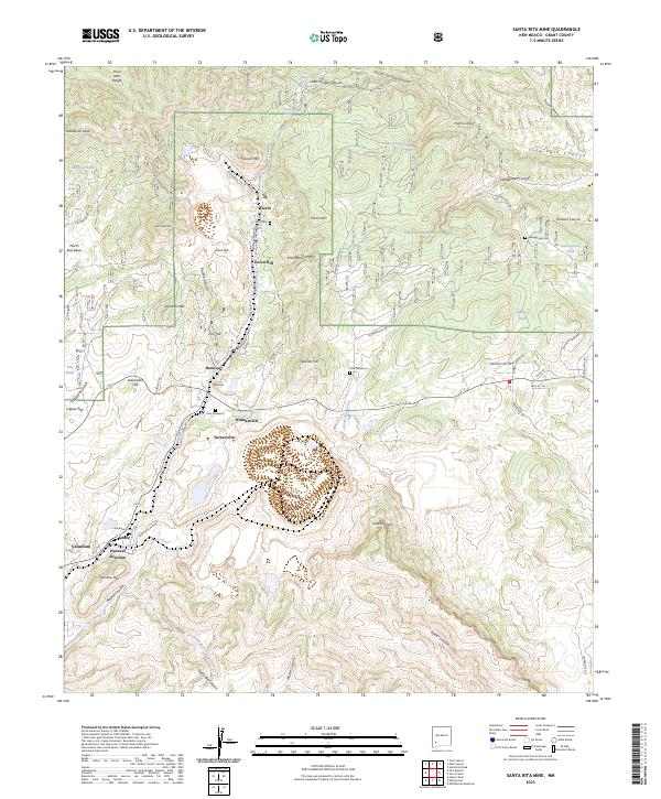
2023 Map of Santa Rita Mine
USGS Topo · Published 2023About this map
Fierro and Hanover stand as the primary centers of this mining landscape, where high-altitude settlement patterns follow the industrial logic of the New Mexico mineral belt. The terrain is marked by significant peaks and landforms, including Hanover Mtn, Hermosa Mtn, and the distinctive Kneeling Nun landmark. A network of specialized cemeteries, such as Fierro Cem and Georgetown Cem, serves as a direct link to the region's genealogical history, while numbered sites like Cem Number 4 and Cem Number 5 indicate the organized, often segregated nature of early mining camp burials. The eastern portion of the map is dominated by the Gila National Forest, preserving the wooded reaches of Middle Shingle Canyon and Brunner Canyon. Transport routes including the Georgetown Rd and Santa Rita Mine Rd connect the scattered residential pockets of Wimsattville and Turnerville to the industrial hubs at Hanover Junction and Vanadium.
Find a feature on this map
71 named features on this map. Tap any name to fly to it.
Don’t see what you’re looking for? This feature index may not catch every label — zoom into the map to look around manually.
Map Details
Editions of this 2023 Santa Rita Mine Map
This is the sole edition of this map. No revisions or reprints were ever made.
Other maps of this area

1909 · Silver City
USGS Topo · 1:125,000

1937 · Santa Rita
USGS Topo · 1:24,000

1947 · Allie Canyon
USGS Topo · 1:24,000

1947 · Twin Sisters
USGS Topo · 1:24,000

1947 · Fort Bayard
USGS Topo · 1:24,000

1948 · Twin Sisters
USGS Topo · 1:24,000

1948 · Santa Rita
USGS Topo · 1:24,000

1948 · Allie Canyon
USGS Topo · 1:24,000

1948 · Hurley East
USGS Topo · 1:24,000

1949 · Fort Bayard
USGS Topo · 1:24,000