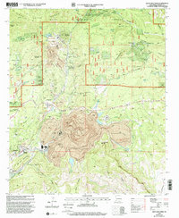
1999 Map of Santa Rita Mine
USGS Topo · Published 2002About this map
The massive excavations of the Santa Rita Mine dominate this 1999 revision, illustrating a landscape defined by industrial copper mining in Grant County. Extensive mine dumps, tailings ponds, and open pits surround the settlements of Fierro, Hanover, and Wimsattville, while the Turnerville (Site) indicates a community displaced by expanding operations. The map provides significant genealogical value through its documentation of the Hanover Sch and several burial grounds, including the Georgetown Cem near the upper canyons.
Find a feature on this map
87 named features on this map. Tap any name to fly to it.
Don’t see what you’re looking for? This feature index may not catch every label — zoom into the map to look around manually.
Map Details
Editions of this 1999 Santa Rita Mine Map
This is the sole edition of this map. No revisions or reprints were ever made.
Other maps of this area

1909 · Silver City
USGS Topo · 1:125,000

1937 · Santa Rita
USGS Topo · 1:24,000

1947 · Allie Canyon
USGS Topo · 1:24,000

1947 · Twin Sisters
USGS Topo · 1:24,000

1947 · Fort Bayard
USGS Topo · 1:24,000

1948 · Twin Sisters
USGS Topo · 1:24,000

1948 · Santa Rita
USGS Topo · 1:24,000

1948 · Allie Canyon
USGS Topo · 1:24,000

1948 · Hurley East
USGS Topo · 1:24,000

1949 · Fort Bayard
USGS Topo · 1:24,000