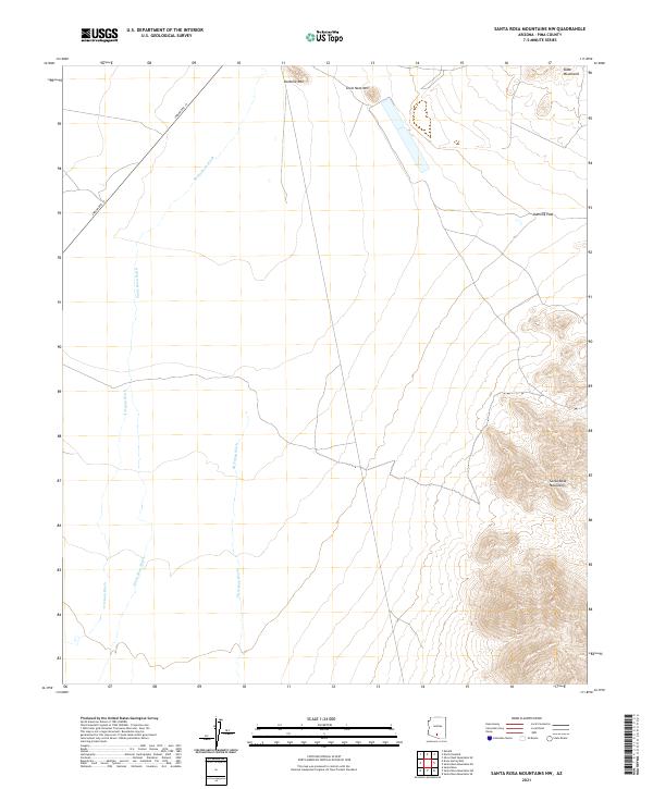
2021 Map of Santa Rosa Mountains NW
USGS Topo · Published 2021About this map
Santa Rosa Mountains and the adjacent Slate Mountains define the high ground of this Pima County landscape, where elevation changes are sharp and immediate. The arid terrain is carved by a network of drainage systems, most notably the wide Santa Rosa Wash, which is joined by the Anegam Wash and Sil Nakya Wash as they trend northward through the valley floors. These ephemeral watercourses dictate the geography of the desert floor between the peaks of Komelik Mtn and Owls Nest Mtn. Transportation through this territory is centered on Indian Rte 15, which skirts the western slopes. The map also documents Komelik Pass, a natural corridor through the ridgelines that has long influenced movement across this part of the Sonoran desert.
Find a feature on this map
13 named features on this map. Tap any name to fly to it.
Don’t see what you’re looking for? This feature index may not catch every label — zoom into the map to look around manually.
Map Details
Editions of this 2021 Santa Rosa Mountains NW Map
This is the sole edition of this map. No revisions or reprints were ever made.
Other maps of this area

1934 · Silver Bell
USGS Topo · 1:125,000

1941 · Vekol Mountains
USGS Topo · 1:62,500

1942 · Silver Reef Mountains
USGS Topo · 1:62,500

1942 · Vekol Mountains
USGS Topo · 1:62,500

1953 · Ajo
USGS Topo · 1:250,000

1956 · Tucson
USGS Topo · 1:250,000

1957 · Ajo
USGS Topo · 1:250,000

1958 · Ajo
USGS Topo · 1:250,000

1958 · Tucson
USGS Topo · 1:250,000

1959 · Tucson
USGS Topo · 1:250,000