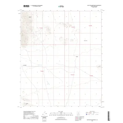
2018 Map of Santa Rosa Mountains SE
USGS Topo · Published 2018About this map
The Santa Rosa Mountains dominate the northwestern corner of this Pima County landscape, giving way to the broad Pipyak Valley as the terrain levels out toward the east. The arid environment is defined by intermittent drainage systems, most notably the winding course of Sil-Nakya Wash, which flows through the center of the quadrangle. Small settlements like Hoi Oidak and Pipyak are situated along local road networks that follow the natural topography of the basin floor.
Find a feature on this map
14 named features on this map. Tap any name to fly to it.
Don’t see what you’re looking for? This feature index may not catch every label — zoom into the map to look around manually.
Map Details
Editions of this 2018 Santa Rosa Mountains SE Map
This is the sole edition of this map. No revisions or reprints were ever made.
Other maps of this area

1934 · Silver Bell
USGS Topo · 1:125,000

1937 · Comobabi
USGS Topo · 1:48,000

1938 · San Vicente
USGS Topo · 1:62,500

1941 · San Vicente
USGS Topo · 1:62,500

1942 · San Vicente
USGS Topo · 1:62,500

1942 · Comobabi
USGS Topo · 1:62,500

1948 · San Vicente
USGS Topo · 1:62,500

1956 · Tucson
USGS Topo · 1:250,000

1958 · Tucson
USGS Topo · 1:250,000

1959 · Tucson
USGS Topo · 1:250,000