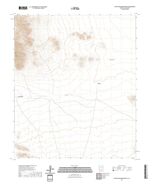
2021 Map of Santa Rosa Mountains SE
USGS Topo · Published 2021About this map
Santa Rosa Mountains and their southeastern foothills define the landscape of this Pima County desert region. The terrain is characterized by broad alluvial valleys and intermittent drainage channels such as Sil-Nakya Wash, which carries seasonal runoff through the arid basins. Settlement is sparse, represented by small communities like Hoi Oidak and Pipyak, which are situated along the lower elevations where the terrain transitions from the rocky slopes of the Sil Nakya Hills to the floor of Pipyak Valley. The map illustrates a traditional desert geography where human habitation is concentrated near the base of prominent ranges. High points like the Vaca Hills stand as distinct landmarks above the desert floor, while the layout of township and range boundaries across the landscape highlights the formal land management of the Tohono O'odham Nation territory.
Find a feature on this map
14 named features on this map. Tap any name to fly to it.
Don’t see what you’re looking for? This feature index may not catch every label — zoom into the map to look around manually.
Map Details
Editions of this 2021 Santa Rosa Mountains SE Map
This is the sole edition of this map. No revisions or reprints were ever made.
Other maps of this area

1934 · Silver Bell
USGS Topo · 1:125,000

1937 · Comobabi
USGS Topo · 1:48,000

1938 · San Vicente
USGS Topo · 1:62,500

1941 · San Vicente
USGS Topo · 1:62,500

1942 · San Vicente
USGS Topo · 1:62,500

1942 · Comobabi
USGS Topo · 1:62,500

1948 · San Vicente
USGS Topo · 1:62,500

1956 · Tucson
USGS Topo · 1:250,000

1958 · Tucson
USGS Topo · 1:250,000

1959 · Tucson
USGS Topo · 1:250,000