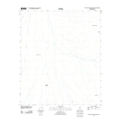
2011 Map of Santa Rosa Mountains SW
USGS Topo · Published 2011About this map
Santa Rosa Valley dominates this desert landscape, defined by a network of drainage systems that converge in the arid basin of the Sif Oidak District. The geography is primarily shaped by the Santa Rosa Wash, Quijotoa Wash, and Sil Nakya Wash, which illustrate the complex water drainage patterns essential for life in this part of Arizona. In the southeast, the terrain rises into the Sil Nakya Hills, while the northeastern edge is marked by the Santa Rosa Mountains and the prominent Gu Achi Peak. Human presence is indicated by the settlements of Makgum Havoka and Bibyak, reflecting the dispersed nature of local communities in the early 21st century. This survey provides a clear view of how these small settlements relate to the high peaks and vast alluvial washes of the Pima County desert.
Find a feature on this map
9 named features on this map. Tap any name to fly to it.
Don’t see what you’re looking for? This feature index may not catch every label — zoom into the map to look around manually.
Map Details
Editions of this 2011 Santa Rosa Mountains SW Map
This is the sole edition of this map. No revisions or reprints were ever made.
Other maps of this area

1934 · Silver Bell
USGS Topo · 1:125,000

1937 · Comobabi
USGS Topo · 1:48,000

1942 · Comobabi
USGS Topo · 1:62,500

1953 · Ajo
USGS Topo · 1:250,000

1956 · Tucson
USGS Topo · 1:250,000

1957 · Ajo
USGS Topo · 1:250,000

1958 · Ajo
USGS Topo · 1:250,000

1958 · Tucson
USGS Topo · 1:250,000

1959 · Tucson
USGS Topo · 1:250,000

1962 · Ajo
USGS Topo · 1:250,000