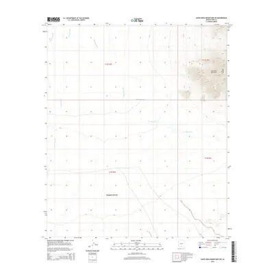
2014 Map of Santa Rosa Mountains SW
USGS Topo · Published 2014About this map
Makgum Havoka sits in a high-desert basin defined by an intricate network of seasonal drainages in this Pima County landscape. The eastern portion of the map is dominated by the dramatic topography of the Santa Rosa Mountains, culminating at Gu Achi Peak. This arid environment is shaped by the convergence of several major washes, including the Santa Rosa Wash, Quijotoa Wash, and the meandering Sil Nakya Wash. Water management in this desert region is represented by isolated features like the Mule Shoe Tank, which serves as a critical point of reference in an otherwise sparsely developed terrain. The map detail highlights the intersection of traditional land use and the natural watershed of the Sif Oidak District.
Find a feature on this map
11 named features on this map. Tap any name to fly to it.
Don’t see what you’re looking for? This feature index may not catch every label — zoom into the map to look around manually.
Map Details
Editions of this 2014 Santa Rosa Mountains SW Map
This is the sole edition of this map. No revisions or reprints were ever made.
Other maps of this area

1934 · Silver Bell
USGS Topo · 1:125,000

1937 · Comobabi
USGS Topo · 1:48,000

1942 · Comobabi
USGS Topo · 1:62,500

1953 · Ajo
USGS Topo · 1:250,000

1956 · Tucson
USGS Topo · 1:250,000

1957 · Ajo
USGS Topo · 1:250,000

1958 · Ajo
USGS Topo · 1:250,000

1958 · Tucson
USGS Topo · 1:250,000

1959 · Tucson
USGS Topo · 1:250,000

1962 · Ajo
USGS Topo · 1:250,000