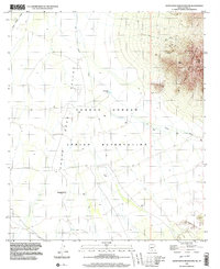
1996 Map of Santa Rosa Mountains SW
USGS Topo · Published 2003About this map
The Tohono O'odham Indian Reservation dominates this desert landscape, where the flat floor of the Santa Rosa Valley meets the high, rocky elevations of the Santa Rosa Mountains. Evidence of early surveying and land management appears at GLO Station 19, while the topography is defined by the braided paths of the Santa Rosa Wash and Sil Nakya Wash.
Find a feature on this map
15 named features on this map. Tap any name to fly to it.
Don’t see what you’re looking for? This feature index may not catch every label — zoom into the map to look around manually.
Map Details
Editions of this 1996 Santa Rosa Mountains SW Map
This is the sole edition of this map. No revisions or reprints were ever made.
Other maps of this area

1934 · Silver Bell
USGS Topo · 1:125,000

1937 · Comobabi
USGS Topo · 1:48,000

1942 · Comobabi
USGS Topo · 1:62,500

1953 · Ajo
USGS Topo · 1:250,000

1956 · Tucson
USGS Topo · 1:250,000

1957 · Ajo
USGS Topo · 1:250,000

1958 · Ajo
USGS Topo · 1:250,000

1958 · Tucson
USGS Topo · 1:250,000

1959 · Tucson
USGS Topo · 1:250,000

1962 · Ajo
USGS Topo · 1:250,000