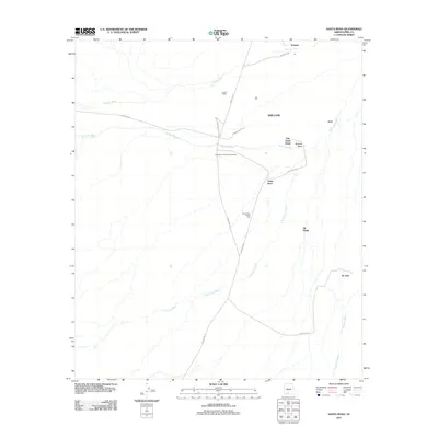
2011 Map of Santa Rosa
USGS Topo · Published 2011About this map
Santa Rosa and surrounding Tohono O'odham settlements anchor this desert landscape, where the seasonal movement of water defines the human geography. The area's communal and commercial hubs are clearly marked, including the Santa Rosa Trading Post and the Santa Rosa Francisco Cemetery, reflecting the enduring cultural presence in the region. Transportation is facilitated by a network of Indian Routes, such as Indian Rte-15 and Indian Rte-34, which connect smaller communities like Anegam, Ali Oidak, and Ak Chin. The topography is characterized by expansive drainage systems like Santa Rosa Wash, Gu Achi Wash, and Anegam Wash, which channel water through Window Valley. These washes are critical landmarks in this arid environment, dictating the placement of settlements like San Luis and smaller locales such as Palo Verde Stand and Achi.
Find a feature on this map
20 named features on this map. Tap any name to fly to it.
Don’t see what you’re looking for? This feature index may not catch every label — zoom into the map to look around manually.
Map Details
Editions of this 2011 Santa Rosa Map
This is the sole edition of this map. No revisions or reprints were ever made.
Other maps of this area

1934 · Silver Bell
USGS Topo · 1:125,000

1937 · Comobabi
USGS Topo · 1:48,000

1942 · Comobabi
USGS Topo · 1:62,500

1953 · Ajo
USGS Topo · 1:250,000

1956 · Tucson
USGS Topo · 1:250,000

1957 · Ajo
USGS Topo · 1:250,000

1958 · Ajo
USGS Topo · 1:250,000

1958 · Tucson
USGS Topo · 1:250,000

1959 · Tucson
USGS Topo · 1:250,000

1962 · Ajo
USGS Topo · 1:250,000
Featured Places
- Anegam, Sif Oidak District
- Ak Chin, Gu Achi District
- San Luis, Gu Achi District
- Palo Verde Stand, Gu Achi District
- Sif Oidak District, AZ