2022 Map of Saticoy
USGS Topo · Published 2022About this map
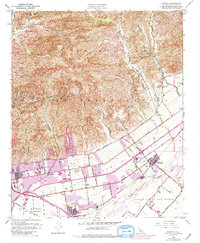
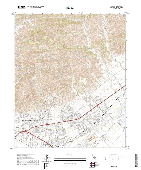
The Santa Clara River forms the southern boundary of this landscape, a region where the urban expansion of San Buenaventura meets the agricultural and industrial corridors of the Ventura River valley. Modern institutional landmarks such as the Ventura County Hall of Justice and the Ventura College campus define the eastern edges of the city, while the nearby Ivy Lawn Memorial Park and Funeral Home provides a significant genealogical reference point. To the east, the historic settlement of Saticoy and its counterpart West Saticoy sit adjacent to the extensive citrus holdings of Limoneira, illustrating the long-standing agricultural roots of the area.
Find a feature on this map
82 named features on this map. Tap any name to fly to it.
Don’t see what you’re looking for? This feature index may not catch every label — zoom into the map to look around manually.
Map Details
Editions of this 2022 Saticoy Map
This is the sole edition of this map. No revisions or reprints were ever made.