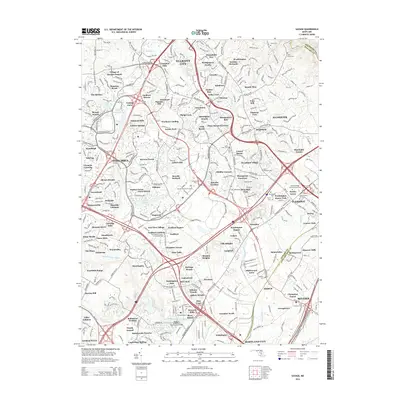
2014 Map of Savage
USGS Topo · Published 2014About this map
Ellicott City and the planned communities of Columbia define the landscape of this 2014 survey. The map records the complex suburban infrastructure and water features of Howard County, including Lake Kittamaqundi, Wilde Lake, and Lake Elkhorn. A notable landmark of industrial heritage is the Bollman Suspension Trussed Bridge crossing the Little Patuxent River, a rare surviving example of its design type. Numerous local cemeteries are documented, ranging from the historic Saint Marys Cem and Cavey Cem to the unique Rosa Bonheur Pet Cem. This edition provides a high-resolution view of the residential growth in neighborhoods like Guilford Downs, Vantage Point, and The Birches at the beginning of the 21st century.
Find a feature on this map
146 named features on this map. Tap any name to fly to it.
Don’t see what you’re looking for? This feature index may not catch every label — zoom into the map to look around manually.
Map Details
Editions of this 2014 Savage Map
This is the sole edition of this map. No revisions or reprints were ever made.
Other maps of this area

1892 · Laurel
USGS Topo · 1:62,500

1892 · Ellicott
USGS Topo · 1:62,500

1894 · Ellicott
USGS Topo · 1:62,500

1894 · Laurel
USGS Topo · 1:62,500

1894 · Baltimore
USGS Topo · 1:62,500

1894 · Relay
USGS Topo · 1:62,500

1897 · Laurel
USGS Topo · 1:62,500

1899 · Baltimore
USGS Topo · 1:62,500

1904 · Baltimore
USGS Topo · 1:62,500

1906 · Ellicott
USGS Topo · 1:62,500