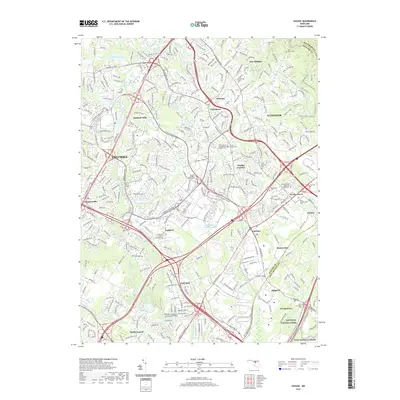
2019 Map of Savage
USGS Topo · Published 2019About this map
The Little Patuxent River and Middle Patuxent River converge near the town of Savage, where the landscape transitions from planned suburban communities to specialized historical landmarks. The area is notable for its high density of memorial sites, including the unique Rosa Bonheur Pet Cem and the Dorsey Owings Waters Cem. Engineering heritage is anchored by the Bollman Suspension and Trussed Bridge, a rare survivor of nineteenth-century iron design.
Find a feature on this map
61 named features on this map. Tap any name to fly to it.
Don’t see what you’re looking for? This feature index may not catch every label — zoom into the map to look around manually.
Map Details
Editions of this 2019 Savage Map
This is the sole edition of this map. No revisions or reprints were ever made.
Other maps of this area

1892 · Laurel
USGS Topo · 1:62,500

1892 · Ellicott
USGS Topo · 1:62,500

1894 · Ellicott
USGS Topo · 1:62,500

1894 · Laurel
USGS Topo · 1:62,500

1894 · Baltimore
USGS Topo · 1:62,500

1894 · Relay
USGS Topo · 1:62,500

1897 · Laurel
USGS Topo · 1:62,500

1899 · Baltimore
USGS Topo · 1:62,500

1904 · Baltimore
USGS Topo · 1:62,500

1906 · Ellicott
USGS Topo · 1:62,500