2021 Map of Savannah
USGS Topo · Published 2021About this map
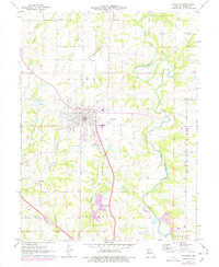
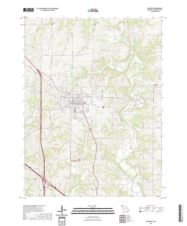
The Andrew County Courthouse serves as the civic anchor for Savannah, Missouri, where the street grid converges around this historic seat of local government. This modern survey illustrates the town's expansion, particularly the residential blocks bounded by N 10th St and W Pearl St. Beyond the urban center, the landscape is defined by the winding course of the One Hundred and Two River and several significant water bodies including Andrew County Lake, City Reservoir, and Ford Lake. For genealogists and local historians, the map provides precise locations for several rural burial grounds such as Kellogg Cem, Coffman Cem, and Greenwick Cem, which are scattered among the agricultural lands surrounding the town. The settlement of Kodiak stands to the east, while drainage features like Dillon Cr and Mace Cr carve through the plateau.
Find a feature on this map
105 named features on this map. Tap any name to fly to it.
Don’t see what you’re looking for? This feature index may not catch every label — zoom into the map to look around manually.
Map Details
Editions of this 2021 Savannah Map
This is the sole edition of this map. No revisions or reprints were ever made.