2023 Map of Saxonburg
USGS Topo · Published 2023About this map
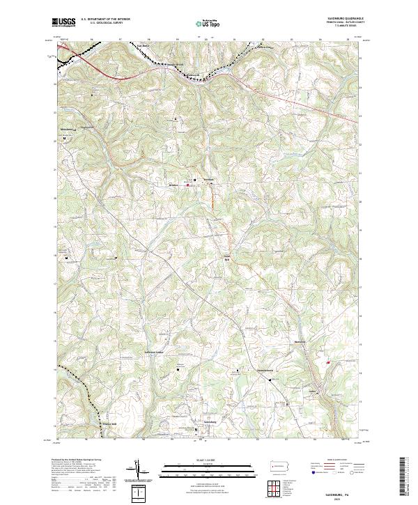
Saxonburg anchors the southern portion of this Butler County landscape, characterized by a series of small villages and hamlets connected by historic corridors. The area is dotted with significant genealogical sites, from the B'nai Abraham Cem in the north to the Knox Chapel Cem and Saxonburg Memorial Church Cem further south. The Butler-Freeport Community Trl winds through the eastern half of the map, tracing a former transportation route that now links communities like Marwood and Cabot.
Find a feature on this map
108 named features on this map. Tap any name to fly to it.
Don’t see what you’re looking for? This feature index may not catch every label — zoom into the map to look around manually.
Map Details
Editions of this 2023 Saxonburg Map
This is the sole edition of this map. No revisions or reprints were ever made.
Historical Maps of Cabot Through Time
Featured Locations
- Saxonburg, PA
- Jefferson Township, PA
- Brinker, Summit Township
- Vogleyville, Summit Township
- Frazier Mill, Jefferson Township