2023 Map of Schuyler Lake
USGS Topo · Published 2023About this map
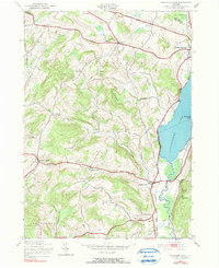
Schuyler Lake and the western shores of Canadarago Lake anchor this 2023 survey of central New York, where the Otsego Co and Herkimer Co boundary meets. The terrain is defined by a series of prominent peaks and high ridges, including Angel Hill, Pigeon Hill, and Panther Mountain, which dictate the winding paths of rural routes like Co RD 22 and Co RD 16. The settlement pattern remains largely agricultural and residential, centered on historic hamlets like Exeter Corner, Lidell Corners, and Richfield.
Find a feature on this map
38 named features on this map. Tap any name to fly to it.
Don’t see what you’re looking for? This feature index may not catch every label — zoom into the map to look around manually.
Map Details
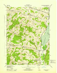
Editions of this 2023 Schuyler Lake Map
This is the sole edition of this map. No revisions or reprints were ever made.
Historical Maps of Dogtown Through Time
3 maps found