Loading...
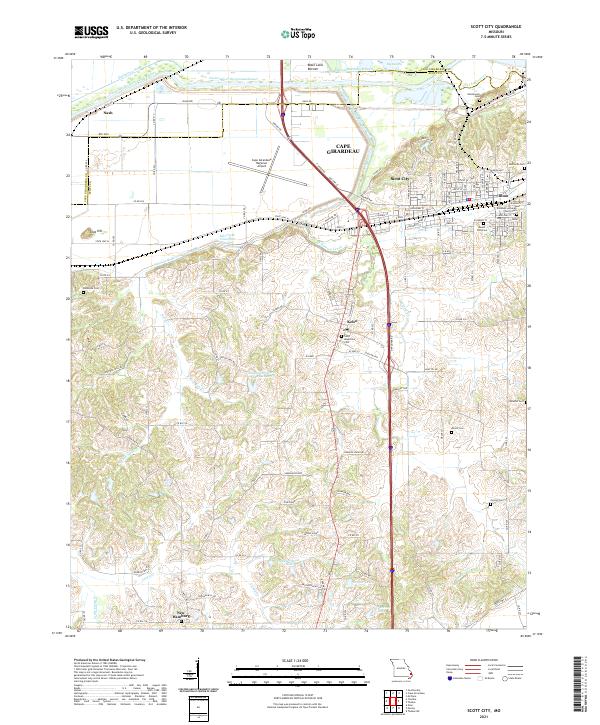
Loading map...2021 Map of Scott City
USGS Topo · Published 2021About this map
Scott City and Illmo stand as the primary urban centers at the edge of the Big Swamp in this modern topographic record. The landscape is defined by extensive water management systems, including the massive Castor River Diversion Channel and the Dutchtown Ditch, which redirect flow through the Black Land Bottom. These engineering works transformed the alluvial terrain north of the undulating hills that house the rural community of New Hamburg.
Find a feature on this map
75 named features on this map. Tap any name to fly to it.
Don’t see what you’re looking for? This feature index may not catch every label — zoom into the map to look around manually.
Map Details
Date Portrayed2021
Date Published2021
PublisherU.S. Geological Survey
Map TypeTopographic
Scale1:24000
Physical Dimensions24 x 29 inches
Editions of this 2021 Scott City Map
This is the sole edition of this map. No revisions or reprints were ever made.
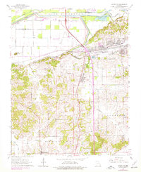
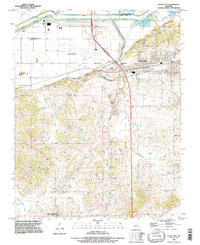
Historical Maps of Illmo Through Time
3 maps found
Featured Locations
Source Details
SourceU.S. Geological Survey
CopyrightPublic Domain