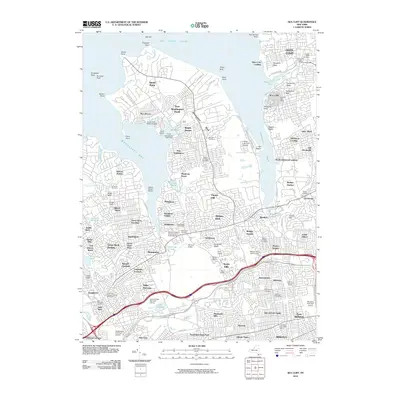
2010 Map of Sea Cliff
USGS Topo · Published 2010About this map
Manhasset Neck and the surrounding north shore peninsulas define this coastal landscape, where the residential character of Nassau County meets the Long Island Sound. The map documents a densely developed suburban fabric punctuated by significant private and memorial lands, including the Whitney Estate, Kelly Estate, and Pulitzer Farms. Local maritime infrastructure is evident at the Sands Point Seaplane Base, Shelter Harbor Marina, and the North Hempstead Town Dock, reflecting the area's long-standing orientation toward Manhasset Bay and Hempstead Harbor.
Find a feature on this map
133 named features on this map. Tap any name to fly to it.
Don’t see what you’re looking for? This feature index may not catch every label — zoom into the map to look around manually.
Map Details
Editions of this 2010 Sea Cliff Map
This is the sole edition of this map. No revisions or reprints were ever made.
Other maps of this area

1889 · Brooklyn
USGS Topo · 1:62,500

1891 · Brooklyn
USGS Topo · 1:62,500

1891 · Harlem
USGS Topo · 1:62,500

1897 · Harlem
USGS Topo · 1:62,500

1897 · Brooklyn
USGS Topo · 1:62,500

1897 · Hempstead
USGS Topo · 1:62,500

1897 · Oyster Bay
USGS Topo · 1:62,500

1898 · Harlem
USGS Topo · 1:62,500

1898 · Hempstead
USGS Topo · 1:62,500

1898 · Brooklyn
USGS Topo · 1:62,500