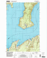
1997 Map of Seabeck
USGS Topo · Published 2003About this map
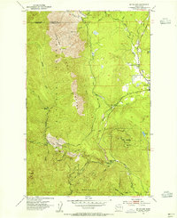
The Toandos Peninsula dominates this maritime landscape, reaching south between Dabob Bay and the Hood Canal. This coastal region is defined by its deeply indented shoreline, where the community of Coyle sits at the peninsula's southern tip, overlooking Fisherman Harbor. On the eastern shore of Seabeck Bay, the settlement of Seabeck is anchored by the Conference Grounds, while recreational and youth activities are evident at Camp Parsons at Jackson Cove. The terrain is marked by numerous points, such as Misery Pt and Hazel Pt, which delineate the intricate waterways used for navigation and logging in the late 20th century. Further inland, the map captures the drainage patterns of Seabeck Creek and Big Beef Creek, as well as a significant Naval Reservation in the northeast, reflecting the strategic military importance of the Kitsap Peninsula shoreline.
Find a feature on this map
33 named features on this map. Tap any name to fly to it.
Don’t see what you’re looking for? This feature index may not catch every label — zoom into the map to look around manually.
Map Details
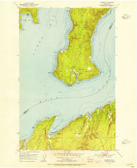
Editions of this 1997 Seabeck Map
This is the sole edition of this map. No revisions or reprints were ever made.
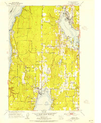
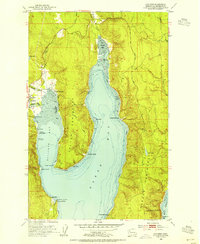
Other maps of this area

1936 · Point Misery
USGS Topo · 1:62,500

1937 · Port Orchard
USGS Topo · 1:62,500

1937 · Port Gamble
USGS Topo · 1:62,500

1940 · Port Gamble
USGS Topo · 1:62,500

1940 · Point Misery
USGS Topo · 1:62,500

1940 · Quilcene
USGS Topo · 1:62,500
1953 · Seabeck
USGS Topo · 1:24,000
1953 · Poulsbo
USGS Topo · 1:24,000
1953 · Quilcene
USGS Topo · 1:24,000
1953 · Mt. Walker
USGS Topo · 1:24,000