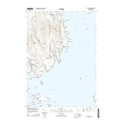
2014 Map of Seal Harbor
USGS Topo · Published 2014About this map
Cadillac Mtn and the coastal peaks of Acadia National Park dominate this coastal landscape, showing the intersection of preserved wilderness and historic seaside communities. The village of Seal Harbor sits tucked between Day Mtn and the Atlantic, while further east, the settlement at Otter Creek is bounded by the dramatic Otter Cliff. On Little Cranberry Island, the community of Islesford represents the enduring maritime character of the region, featuring the Stanley Gilley Cem and a network of local roads like Coast Guard Rd. The map details the complex shoreline of Mount Desert Island, tracing landmarks from Great Head down to Hunters Head. Interior features such as The Tarn, Bubble Pond, and the Sieur de Monts Spring reflect the area's long-standing role as a destination for hikers and nature enthusiasts.
Find a feature on this map
132 named features on this map. Tap any name to fly to it.
Don’t see what you’re looking for? This feature index may not catch every label — zoom into the map to look around manually.
Map Details
Editions of this 2014 Seal Harbor Map
This is the sole edition of this map. No revisions or reprints were ever made.
Other maps of this area

1904 · Mount Desert
USGS Topo · 1:62,500

1904 · Swan Island
USGS Topo · 1:62,500

1904 · Bar Harbor
USGS Topo · 1:62,500

1942 · Bar Harbor
USGS Topo · 1:62,500

1942 · Mount Desert
USGS Topo · 1:62,500

1943 · Swans Island
USGS Topo · 1:62,500

1945 · Swans Island
USGS Topo · 1:62,500

1948 · Bangor
USGS Topo · 1:250,000

1956 · Bar Harbor
USGS Topo · 1:62,500

1956 · Mount Desert
USGS Topo · 1:62,500