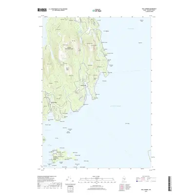
2018 Map of Seal Harbor
USGS Topo · Published 2018About this map
Acadia National Park dominates this coastal landscape, where the granite peaks of Cadillac Mtn and Champlain Mtn overlook the Atlantic. The shoreline is defined by dramatic geology, from the deep cleft of The Gorge to the famous surf at Thunder Hole and the sheltered waters of Otter Cove. Settlement is concentrated in the villages of Seal Harbor and Otter Creek, which are connected by the iconic Park Loop Rd and Ocean Dr. In the southern reaches, the map captures the community of Islesford on Little Cranberry Island, showing a distinct island economy tied to Cranberry Harbor and The Gut. Local history is preserved in small, family-named burial sites like Stanley Grave and the Gilley Cem, documenting the genealogy of Mount Desert Island's early inhabitants before the era of intensive conservation and tourism transformed the region.
Find a feature on this map
125 named features on this map. Tap any name to fly to it.
Don’t see what you’re looking for? This feature index may not catch every label — zoom into the map to look around manually.
Map Details
Editions of this 2018 Seal Harbor Map
This is the sole edition of this map. No revisions or reprints were ever made.
Other maps of this area

1904 · Mount Desert
USGS Topo · 1:62,500

1904 · Swan Island
USGS Topo · 1:62,500

1904 · Bar Harbor
USGS Topo · 1:62,500

1942 · Bar Harbor
USGS Topo · 1:62,500

1942 · Mount Desert
USGS Topo · 1:62,500

1943 · Swans Island
USGS Topo · 1:62,500

1945 · Swans Island
USGS Topo · 1:62,500

1948 · Bangor
USGS Topo · 1:250,000

1956 · Bar Harbor
USGS Topo · 1:62,500

1956 · Mount Desert
USGS Topo · 1:62,500