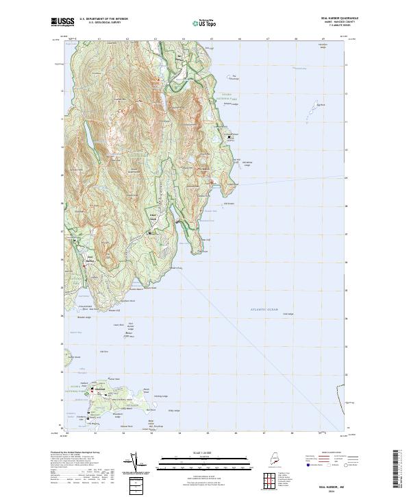
2024 Map of Seal Harbor
USGS Topo · Published 2024About this map
Cadillac Mtn and the granite peaks of Acadia National Park dominate the landscape of Mount Desert Island in this contemporary 2024 survey. The rugged coastal geography includes prominent landmarks such as The Beehive, The Gorge, and Thunder Hole, where the Atlantic Ocean meets the jagged shoreline at Otter Point. The map details an extensive network of historic pathways, including the Eagle Lake Carriage Road Trl and the Jordan Pond Loop Carriage Road Trl, reflecting the long-standing recreational heritage of the area.
Find a feature on this map
144 named features on this map. Tap any name to fly to it.
Don’t see what you’re looking for? This feature index may not catch every label — zoom into the map to look around manually.
Map Details
Editions of this 2024 Seal Harbor Map
This is the sole edition of this map. No revisions or reprints were ever made.
Other maps of this area

1904 · Mount Desert
USGS Topo · 1:62,500

1904 · Swan Island
USGS Topo · 1:62,500

1904 · Bar Harbor
USGS Topo · 1:62,500

1942 · Bar Harbor
USGS Topo · 1:62,500

1942 · Mount Desert
USGS Topo · 1:62,500

1943 · Swans Island
USGS Topo · 1:62,500

1945 · Swans Island
USGS Topo · 1:62,500

1948 · Bangor
USGS Topo · 1:250,000

1956 · Bar Harbor
USGS Topo · 1:62,500

1956 · Mount Desert
USGS Topo · 1:62,500