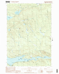
1988 Map of Sebec Lake East
USGS Topo · Published 1988About this map
Sebec Lake dominates the southern landscape of this Maine interior, with its irregular northern shoreline defined by Newell Cove, Picked Cove, and Lyford Cove. The settlement pattern centers on waterfront access points like Greeleys Landing, Steadman Landing, and Parson Landing, while the community of Barnard sits to the north near Roaring Brook.
Find a feature on this map
50 named features on this map. Tap any name to fly to it.
Don’t see what you’re looking for? This feature index may not catch every label — zoom into the map to look around manually.
Map Details
Editions of this 1988 Sebec Lake East Map
2 editions found

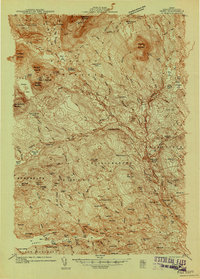
Other maps of this area

1932 · Dover-Foxcroft
USGS Topo · 1:48,000

1933 · Guilford
USGS Topo · 1:62,500

1935 · Dover-Foxcroft
USGS Topo · 1:62,500

1937 · Guilford
USGS Topo · 1:62,500
1940 · Sebec
USGS Topo · 1:48,000
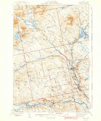
1943 · Sebec
USGS Topo · 1:62,500
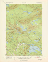
1950 · Sebec Lake
USGS Topo · 1:62,500

1954 · Millinocket
USGS Topo · 1:250,000

1958 · Millinocket
USGS Topo · 1:250,000

1960 · Millinocket
USGS Topo · 1:250,000