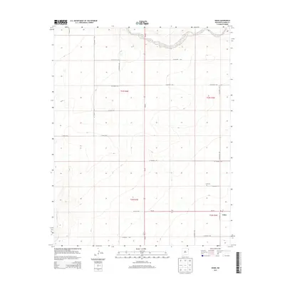
2013 Map of Sedan
USGS Topo · Published 2013About this map
Sedan and its surrounding high plains ranching landscape are documented here in the early twenty-first century, showing the dispersed settlement pattern of northeastern New Mexico. The community is anchored by the Sedan Cem and a Po, which serve as the primary social and infrastructure markers for this corner of Union County. The terrain is defined by the winding course of Carrizo Cr in the north and the headwaters of Pinabetes Cr in the southwest, features that have historically dictated the placement of roads and homesteads. The map illustrates a sparse but organized grid of county and state routes, including NM-102 and Co Highway C-050, which connect these isolated holdings to the broader region. This survey captures the enduring character of a rural outpost where large-scale land management is reflected in the section lines of the Public Land Survey System, including t23n r35e and t22n r36e.
Find a feature on this map
24 named features on this map. Tap any name to fly to it.
Don’t see what you’re looking for? This feature index may not catch every label — zoom into the map to look around manually.
Map Details
Editions of this 2013 Sedan Map
This is the sole edition of this map. No revisions or reprints were ever made.
Other maps of this area

1954 · Dalhart
USGS Topo · 1:250,000

1958 · Dalhart
USGS Topo · 1:250,000

1962 · Dalhart
USGS Topo · 1:250,000

1966 · Skull Mesa
USGS Topo · 1:24,000

1966 · Clapham
USGS Topo · 1:24,000

1966 · Sand Hill
USGS Topo · 1:24,000

1970 · Stead
USGS Topo · 1:24,000

1970 · Texline South
USGS Topo · 1:24,000

1970 · Clayton SW
USGS Topo · 1:24,000

1970 · Sedan
USGS Topo · 1:24,000