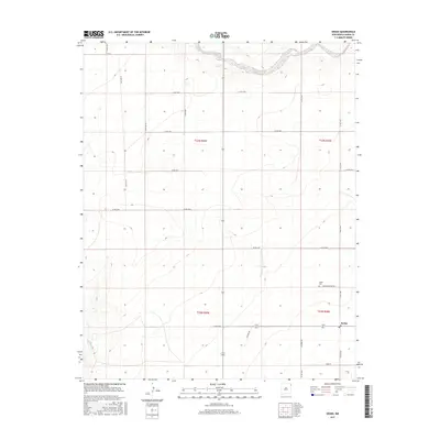
2017 Map of Sedan
USGS Topo · Published 2017About this map
Sedan and its surrounding ranchlands are characterized by a wide grid of rural roads and the intermittent drainage of Pinabete Cr in the southwestern corner. The settlement is centered at the intersection of several named thoroughfares, including Callis Rd and Co RD c048. Local history and genealogy are anchored at the Sedan Cem, located just north of the town center along Sedan Cemetery Rd. The landscape reflects the expansive township and range system typical of Northeastern New Mexico, with land divisions such as t23n r35e and t22n r36e organizing the territory. Other primary connectors like Anderson Rd, Beamer Rd, and Lechner Rd serve the surrounding countryside, linking remote homesteads and grazing lands to the community hub of Sedan.
Find a feature on this map
26 named features on this map. Tap any name to fly to it.
Don’t see what you’re looking for? This feature index may not catch every label — zoom into the map to look around manually.
Map Details
Editions of this 2017 Sedan Map
This is the sole edition of this map. No revisions or reprints were ever made.
Other maps of this area

1954 · Dalhart
USGS Topo · 1:250,000

1958 · Dalhart
USGS Topo · 1:250,000

1962 · Dalhart
USGS Topo · 1:250,000

1966 · Skull Mesa
USGS Topo · 1:24,000

1966 · Clapham
USGS Topo · 1:24,000

1966 · Sand Hill
USGS Topo · 1:24,000

1970 · Stead
USGS Topo · 1:24,000

1970 · Texline South
USGS Topo · 1:24,000

1970 · Clayton SW
USGS Topo · 1:24,000

1970 · Sedan
USGS Topo · 1:24,000