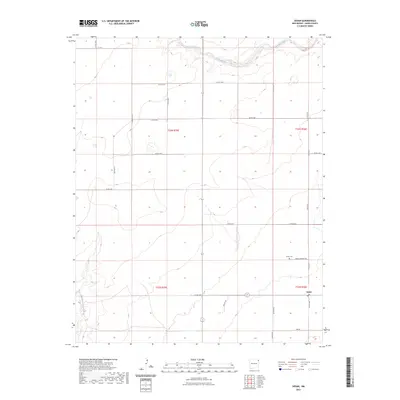
2023 Map of Sedan
USGS Topo · Published 2023About this map
The settlement of Sedan serves as the primary focal point of this high-plains landscape in Union County. The surrounding terrain is defined by the ephemeral flow of Carrizo Creek and Pinabete Creek, which carve subtle drainage patterns across the grazing lands of northeastern New Mexico. Local history and genealogy are centered on the Sedan Cem, accessible via Sedan Cemetery Rd. A grid of section-line roads, many bearing family names such as Anderson Rd, Callis Rd, Beamer Rd, and Lechner Rd, reveals the enduring structure of the Public Land Survey System. These routes connect isolated homesteads and ranching operations, tracing the persistent agricultural heritage of the High Plains into the modern era.
Find a feature on this map
25 named features on this map. Tap any name to fly to it.
Don’t see what you’re looking for? This feature index may not catch every label — zoom into the map to look around manually.
Map Details
Editions of this 2023 Sedan Map
This is the sole edition of this map. No revisions or reprints were ever made.
Other maps of this area

1954 · Dalhart
USGS Topo · 1:250,000

1958 · Dalhart
USGS Topo · 1:250,000

1962 · Dalhart
USGS Topo · 1:250,000

1966 · Skull Mesa
USGS Topo · 1:24,000

1966 · Clapham
USGS Topo · 1:24,000

1966 · Sand Hill
USGS Topo · 1:24,000

1970 · Stead
USGS Topo · 1:24,000

1970 · Texline South
USGS Topo · 1:24,000

1970 · Clayton SW
USGS Topo · 1:24,000

1970 · Sedan
USGS Topo · 1:24,000