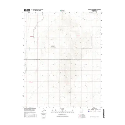
2014 Map of Senator Mountain NW
USGS Topo · Published 2014About this map
Lake Mead National Recreation Area dominates the northern reaches of this high-desert landscape, where the arid terrain of the Mojave Desert meets the dramatic elevation changes of northwestern Arizona. The topography is defined by the stark ridges of the White Hills and the prominent summit of Squaw Peak, reflecting a landscape shaped by drainage patterns and seasonal water flow. Notable among these is Detrital Wash, which carves through the western portion of the map, and the winding route of Temple Bar Rd providing the primary access through this remote territory. The map illustrates a transitional zone where recreation land meets open desert, documented with precision through contemporary USGS surveying.
Find a feature on this map
10 named features on this map. Tap any name to fly to it.
Don’t see what you’re looking for? This feature index may not catch every label — zoom into the map to look around manually.
Map Details
Editions of this 2014 Senator Mountain NW Map
This is the sole edition of this map. No revisions or reprints were ever made.
Other maps of this area

1886 · Camp Mohave
USGS Topo · 1:250,000

1886 · Saint Thomas
USGS Topo · 1:250,000

1892 · Camp Mohave
USGS Topo · 1:250,000

1893 · Saint Thomas
USGS Topo · 1:250,000

1926 · Nelson
USGS Topo · 1:96,000

1926 · Bonelli
USGS Topo · 1:96,000

1926 · Boulder Canyon
USGS Topo · 1:96,000

1942 · Camp Mohave
USGS Topo · 1:250,000

1947 · Kingman
USGS Topo · 1:250,000

1948 · Kingman
USGS Topo · 1:250,000