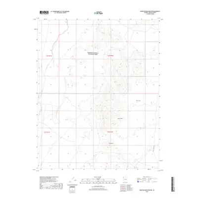
2018 Map of Senator Mountain NW
USGS Topo · Published 2018About this map
The Lake Mead National Recreation Area dominates the northern reaches of this landscape, where the arid terrain transitions into the high elevations of the White Hills. This 2018 survey reveals a sparse network of infrastructure centered on the eastern edge of the Mojave Desert, characterized by significant elevation changes near Squaw Peak. The hydrological profile is defined by the prominent Detrital Wash, which cuts through the western portion of the quadrangle. Transportation is limited to rugged access routes such as CO Hwy 143 and the Temple Bar Back Rd, reflecting the remote and protected status of this Mohave County territory. The map provides a precise view of the Public Land Survey System grid, including the intersection of townships T30N and T29N, essential for modern land-use research.
Find a feature on this map
11 named features on this map. Tap any name to fly to it.
Don’t see what you’re looking for? This feature index may not catch every label — zoom into the map to look around manually.
Map Details
Editions of this 2018 Senator Mountain NW Map
This is the sole edition of this map. No revisions or reprints were ever made.
Other maps of this area

1886 · Camp Mohave
USGS Topo · 1:250,000

1886 · Saint Thomas
USGS Topo · 1:250,000

1892 · Camp Mohave
USGS Topo · 1:250,000

1893 · Saint Thomas
USGS Topo · 1:250,000

1926 · Nelson
USGS Topo · 1:96,000

1926 · Bonelli
USGS Topo · 1:96,000

1926 · Boulder Canyon
USGS Topo · 1:96,000

1942 · Camp Mohave
USGS Topo · 1:250,000

1947 · Kingman
USGS Topo · 1:250,000

1948 · Kingman
USGS Topo · 1:250,000