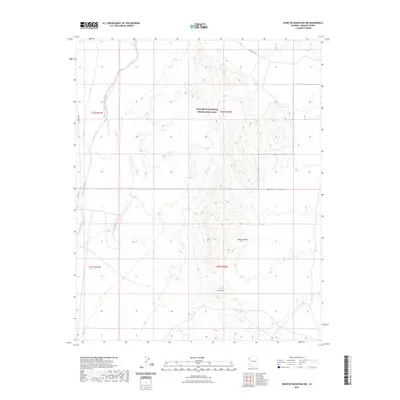
2021 Map of Senator Mountain NW
USGS Topo · Published 2021About this map
Detrital Valley dominates this arid landscape within the Lake Mead National Recreation Area, where drainage systems carve through the northwestern Mojave Desert. The map details the transition from the broad alluvial floor of Detrital Wash to the rising elevations of the White Hills and Squaw Peak. This modern 2021 survey serves as a definitive record of the desert's shifting topography and current infrastructure, including the reach of Temple Bar Rd and Co Hwy 143. The layout reflects the vast, undeveloped nature of Mohave County's backcountry, revealing how natural drainage patterns and high peaks dictate the few access routes through this protected federal land.
Find a feature on this map
12 named features on this map. Tap any name to fly to it.
Don’t see what you’re looking for? This feature index may not catch every label — zoom into the map to look around manually.
Map Details
Editions of this 2021 Senator Mountain NW Map
This is the sole edition of this map. No revisions or reprints were ever made.
Other maps of this area

1886 · Camp Mohave
USGS Topo · 1:250,000

1886 · Saint Thomas
USGS Topo · 1:250,000

1892 · Camp Mohave
USGS Topo · 1:250,000

1893 · Saint Thomas
USGS Topo · 1:250,000

1926 · Nelson
USGS Topo · 1:96,000

1926 · Bonelli
USGS Topo · 1:96,000

1926 · Boulder Canyon
USGS Topo · 1:96,000

1942 · Camp Mohave
USGS Topo · 1:250,000

1947 · Kingman
USGS Topo · 1:250,000

1948 · Kingman
USGS Topo · 1:250,000