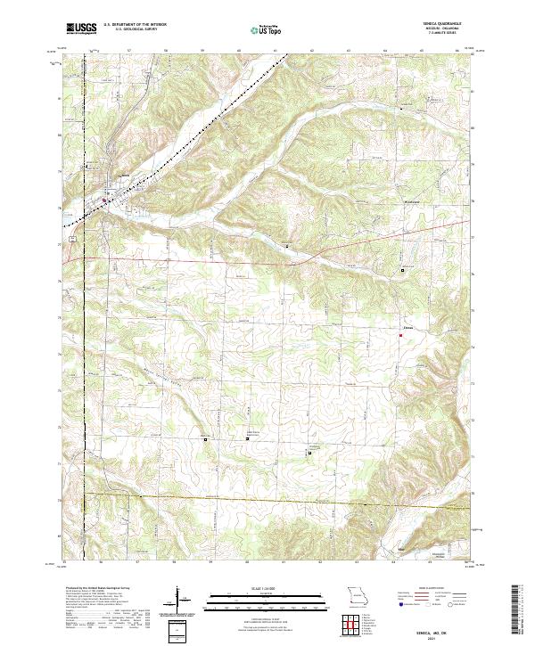
2021 Map of Seneca
USGS Topo · Published 2021About this map
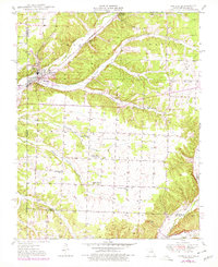
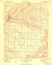
Seneca occupies the northwestern corner of this study, sitting at the junction of several prominent local routes and the Lost Cr drainage. This Missouri-Oklahoma borderlands area is characterized by a high concentration of burial sites and rural communities, including the Swars Prairie Baptist Cem and Thompson Grove Cem. The landscape is etched by a series of narrow valleys and ridges, most notably Mason Springs Valley and Charlton Hollow, which dictate the placement of small settlements like Westview and Dessa. Numerous named watercourses, such as Sycamore Cr and Buffalo Cr, flow through the terrain, historically influencing the early road networks that now connect these agricultural and residential pockets. Genealogists will find particular value in the clearly marked family and community plots including Wash Cem and Wilson Cem.
Find a feature on this map
101 named features on this map. Tap any name to fly to it.
Don’t see what you’re looking for? This feature index may not catch every label — zoom into the map to look around manually.
Map Details
Editions of this 2021 Seneca Map
This is the sole edition of this map. No revisions or reprints were ever made.