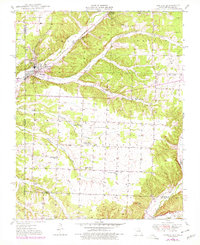
1949 Map of Seneca
USGS Topo · Published 1979About this map
The St Louis San Francisco railroad cuts a diagonal path through the landscape of southwest Missouri and northeast Oklahoma, anchoring the border town of Seneca. This 1949 survey, with revisions from 1977, reveals a rural economy shaped by both agriculture and mineral extraction, evidenced by a Strip Mine and the specialized Tripoli Mine in the northern hills. The terrain is defined by the drainage of Little Lost Creek and Sycamore Creek, which carve through the Seneca and Dayton districts.
Find a feature on this map
32 named features on this map. Tap any name to fly to it.
Don’t see what you’re looking for? This feature index may not catch every label — zoom into the map to look around manually.
Map Details
Editions of this 1949 Seneca Map
2 editions found
Other maps of this area

1907 · Wyandotte
USGS Topo · 1:125,000

1909 · Wyandotte
USGS Topo · 1:125,000

1916 · Neosho
USGS Topo · 1:62,500

1940 · Noel
USGS Topo · 1:62,500

1943 · Noel
USGS Topo · 1:62,500

1949 · Seneca
USGS Topo · 1:24,000

1949 · Racine
USGS Topo · 1:24,000

1950 · Seneca
USGS Topo · 1:24,000

1950 · Racine
USGS Topo · 1:24,000

1954 · Tulsa
USGS Topo · 1:250,000