
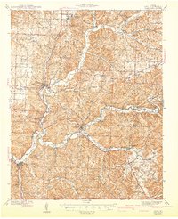
1943 Map of Noel
USGS Topo · Published 1943About this map
Pineville and Noel anchor this mid-century survey of McDonald County, where the Elk River and Little Sugar Creek carve deep valleys through the Ozark landscape. The mapping captures a transition in regional travel as U S Highway 71 follows the north-south ridges, while the Kansas City Southern railroad snakes along the riverbanks near Lanagan and Elk Springs. Local geography is defined by a dense network of rural school districts and family landmarks, such as Puckett Sch, Banner Sch, and Kelley Spring. Notable landmarks like Bluff Dwellers Cave and Bear Cavern suggest the early development of the region's cave tourism, while the presence of Coal Mine Hill and several bluffs like Sugar Beach Bluff and White Rock Bluff underscore the area's geological variety.
Find a feature on this map
68 named features on this map. Tap any name to fly to it.
Don’t see what you’re looking for? This feature index may not catch every label — zoom into the map to look around manually.
Map Details
Editions of this 1943 Noel Map
2 editions found
Other maps of this area

1899 · Fayetteville
USGS Topo · 1:125,000

1899 · Siloam Springs
USGS Topo · 1:125,000

1901 · Fayetteville
USGS Topo · 1:125,000

1903 · Siloam Springs
USGS Topo · 1:125,000

1904 · Siloam Springs
USGS Topo · 1:125,000

1904 · Fayetteville
USGS Topo · 1:125,000

1907 · Wyandotte
USGS Topo · 1:125,000

1909 · Wyandotte
USGS Topo · 1:125,000

1916 · Neosho
USGS Topo · 1:62,500

1940 · Noel
USGS Topo · 1:62,500