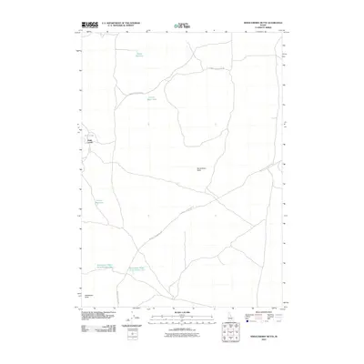
2010 Map of Serviceberry Butte
USGS Topo · Published 2010About this map
Serviceberry Butte and Rattlesnake Butte anchor this desert landscape in Blaine County, Idaho, where the movement of livestock and water management define the map's character. The presence of Smith Corrals near Pratt Lake suggests a history of ranching activity in a region where water sources are vital yet sparse. This reliance on seasonal or managed water is evidenced by a network of catchments, including Muddy Reservoir, Harold Reservoir, and the uniquely named Coyote Water Hole. Transportation through this arid terrain follows established routes such as the Minidoka to Arco Rd and the Big Butte Springfield Rd, providing insight into the connectivity between distant range points. Additionally, the paired Rattlesnake Water Hole Number One and Rattlesnake Water Hole Number Two indicate intentional water engineering to support life and industry across the sagebrush-dominated plains of the Snake River Plain vicinity.
Find a feature on this map
12 named features on this map. Tap any name to fly to it.
Don’t see what you’re looking for? This feature index may not catch every label — zoom into the map to look around manually.
Map Details
Editions of this 2010 Serviceberry Butte Map
This is the sole edition of this map. No revisions or reprints were ever made.
Other maps of this area

1955 · Idaho Falls
USGS Topo · 1:250,000

1958 · Idaho Falls
USGS Topo · 1:250,000

1972 · Quaking Aspen Butte
USGS Topo · 1:24,000

1972 · Antelope Lake
USGS Topo · 1:24,000

1972 · Split Top
USGS Topo · 1:24,000

1972 · Big Southern Butte
USGS Topo · 1:24,000

1972 · Pratt Butte
USGS Topo · 1:24,000

1972 · Bear Park East
USGS Topo · 1:24,000

1972 · Sunset Lake
USGS Topo · 1:24,000

1972 · Fingers Butte
USGS Topo · 1:24,000