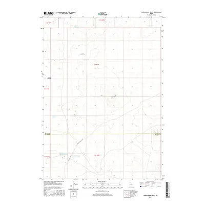
2017 Map of Serviceberry Butte
USGS Topo · Published 2017About this map
Serviceberry Butte rises as a prominent landmark in this high desert landscape along the border of Butte and Blaine counties. The map documents a critical network of water resources essential for life in this arid environment, featuring established points such as Coyote Water Hole, Rocky Point Water Hole, and the dual sites of Rattlesnake Water Hole Number One and Rattlesnake Water Hole Number Two. Human activity is centered around livestock management and transport, anchored by Smith Corrals and the catchment at Harold Reservoir. The area is bisected by historic regional thoroughfares, most notably the Minidoka to Arco Rd and the Big Butte Springfield Rd, reflecting the long-established transit corridors of the Snake River Plain hinterlands.
Find a feature on this map
18 named features on this map. Tap any name to fly to it.
Don’t see what you’re looking for? This feature index may not catch every label — zoom into the map to look around manually.
Map Details
Editions of this 2017 Serviceberry Butte Map
This is the sole edition of this map. No revisions or reprints were ever made.
Other maps of this area

1955 · Idaho Falls
USGS Topo · 1:250,000

1958 · Idaho Falls
USGS Topo · 1:250,000

1972 · Quaking Aspen Butte
USGS Topo · 1:24,000

1972 · Antelope Lake
USGS Topo · 1:24,000

1972 · Split Top
USGS Topo · 1:24,000

1972 · Big Southern Butte
USGS Topo · 1:24,000

1972 · Pratt Butte
USGS Topo · 1:24,000

1972 · Bear Park East
USGS Topo · 1:24,000

1972 · Sunset Lake
USGS Topo · 1:24,000

1972 · Fingers Butte
USGS Topo · 1:24,000