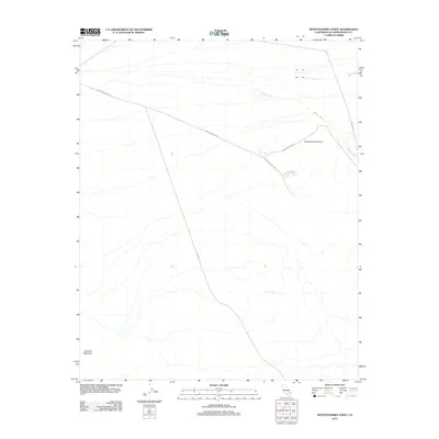
2012 Map of Seventeenmile Point
USGS Topo · Published 2012About this map
Seventeenmile Point stands as a prominent landmark in this desert expanse of San Bernardino County, where the topography is defined by the massive rise of Cowhole Mountain to the southwest. This 2012 survey illustrates a landscape primarily shaped by isolated mining access and long-distance desert corridors. Several unpaved routes, including Brannigan Mine Rd and Paymaster Mine Rd, intersect near the central heights, suggesting a history of mineral exploration in the surrounding slopes. Seasonal drainage patterns are marked by the intermittent paths of Willow Wash and Indian Cr, which cut through the arid terrain. Modern infrastructure is represented by the north-south transit of Kelso Rd and the presence of Tank Nine, a critical water resource in this dry environment. The convergence of Hidden Valley Rd with the mining tracks highlights the network of primitive roads used to navigate the high desert floor.
Find a feature on this map
10 named features on this map. Tap any name to fly to it.
Don’t see what you’re looking for? This feature index may not catch every label — zoom into the map to look around manually.
Map Details
Editions of this 2012 Seventeenmile Point Map
This is the sole edition of this map. No revisions or reprints were ever made.
Other maps of this area

1910 · Ivanpah
USGS Topo · 1:250,000

1912 · Ivanpah
USGS Topo · 1:250,000

1933 · Avawatz Mountains
USGS Topo · 1:250,000

1942 · Ivanpah
USGS Topo · 1:250,000

1947 · Trona
USGS Topo · 1:250,000

1947 · Kingman
USGS Topo · 1:250,000

1948 · Kingman
USGS Topo · 1:250,000

1948 · Trona
USGS Topo · 1:250,000

1953 · Trona
USGS Topo · 1:250,000

1954 · Kingman
USGS Topo · 1:250,000