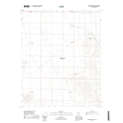
2018 Map of Seventeenmile Point
USGS Topo · Published 2018About this map
Mojave National Preserve encompasses the central expanse of this 2018 survey, documenting a stark desert landscape defined by high-elevation landforms and seasonal drainages. The namesake Seventeenmile Point rises in the northeast corner of the quadrangle, serving as a significant topographical anchor within the Mojave Desert. To the southwest, the distinctive peaks of Cowhole Mtn and Little Cowhole Mtn emerge from the basin floor, while ephemeral water features like Willow Wash and Indian Cr trace the natural drainage patterns that shape this arid environment. This map details the complex terrain and public land boundaries during a period of modern preservation, providing a clear record of the intersection between prominent geological formations and established protected lands in San Bernardino County.
Find a feature on this map
13 named features on this map. Tap any name to fly to it.
Don’t see what you’re looking for? This feature index may not catch every label — zoom into the map to look around manually.
Map Details
Editions of this 2018 Seventeenmile Point Map
This is the sole edition of this map. No revisions or reprints were ever made.
Other maps of this area

1910 · Ivanpah
USGS Topo · 1:250,000

1912 · Ivanpah
USGS Topo · 1:250,000

1933 · Avawatz Mountains
USGS Topo · 1:250,000

1942 · Ivanpah
USGS Topo · 1:250,000

1947 · Trona
USGS Topo · 1:250,000

1947 · Kingman
USGS Topo · 1:250,000

1948 · Kingman
USGS Topo · 1:250,000

1948 · Trona
USGS Topo · 1:250,000

1953 · Trona
USGS Topo · 1:250,000

1954 · Kingman
USGS Topo · 1:250,000