2023 Map of Shady Spring
USGS Topo · Published 2023About this map
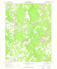
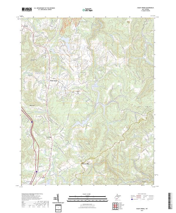
Shady Spring Mountain and White Oak Mtn define the high ground of this Appalachian landscape, where development is concentrated along the ridge-top corridors between the Raleigh and Summers county line. The map highlights a transition from established settlements like Shady Spring and Daniels to the more rural south near Ghent and Streeter. Water management is a primary feature of the local infrastructure, evidenced by the Glade Creek Reservoir and the Beckly Water Supply Number One Lake. Local history and genealogy interests are well-served by the inclusion of the Salem Church and its associated Salem Church Cem, along with the Mountview Cem. The drainage patterns of Glade Creek and Little Beaver Creek illustrate the dissected topography that has historically guided the placement of roads like Flat Top Rd and the Blue Jay 6 Rd.
Find a feature on this map
149 named features on this map. Tap any name to fly to it.
Don’t see what you’re looking for? This feature index may not catch every label — zoom into the map to look around manually.
Map Details
Editions of this 2023 Shady Spring Map
This is the sole edition of this map. No revisions or reprints were ever made.