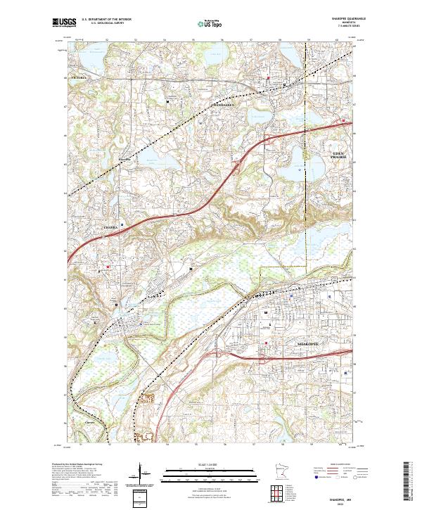
2022 Map of Shakopee
USGS Topo · Published 2022About this map
The Minnesota River carves a broad valley through this suburban landscape, serving as the historical and geographic divide between Chaska and Shakopee. Along the northern banks, industrial roots are evident in features like the Brickyard Clayhole and Firemens Clayhole, while the Minnesota Valley State Trl follows the river's winding course. This modern survey illustrates the dense intersection of transit and community infrastructure, including the Carver County Justice Center and several regional cemeteries that mark the area's growth.
Find a feature on this map
57 named features on this map. Tap any name to fly to it.
Don’t see what you’re looking for? This feature index may not catch every label — zoom into the map to look around manually.
Map Details
Editions of this 2022 Shakopee Map
This is the sole edition of this map. No revisions or reprints were ever made.