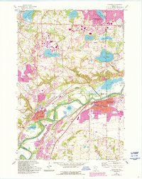
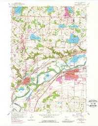
1958 Map of Shakopee
USGS Topo · Published 1993About this map
The Minnesota River meanders through this landscape, carving a wide valley that defines the boundary between Shakopee and the rising uplands to the north. In the mid-20th century, this area maintained a balance between burgeoning riverfront industry and its established agricultural roots. Settlement patterns are dense near the river in Chaska and Shakopee, while the northern sections in Chanhassen and Eden Prairie are characterized by numerous glacial basins, including Lake Minnewashta and Lake Riley. The map reveals a high concentration of religious and educational institutions, such as Assumption Seminary and St Marys Sch, alongside several dedicated burial grounds like Moravian Cem and Guardian Angel Cem. Significant industrial markers, including Gravel Pits and a Gaging Station on the river, highlight the economic reliance on the valley's natural resources and hydrology.
Find a feature on this map
41 named features on this map. Tap any name to fly to it.
Don’t see what you’re looking for? This feature index may not catch every label — zoom into the map to look around manually.
Map Details
Editions of this 1958 Shakopee Map
5 editions found
Other maps of this area

1896 · Minneapolis
USGS Topo · 1:62,500

1901 · Minneapolis
USGS Topo · 1:62,500

1905 · Minnetonka
USGS Topo · 1:62,500

1907 · Minnetonka
USGS Topo · 1:62,500

1953 · Saint Paul
USGS Topo · 1:250,000

1954 · Hopkins
USGS Topo · 1:24,000

1954 · Eden Prairie
USGS Topo · 1:24,000

1954 · Minneapolis
USGS Topo · 1:62,500

1957 · Prior Lake
USGS Topo · 1:62,500

1957 · New Prague
USGS Topo · 1:62,500