
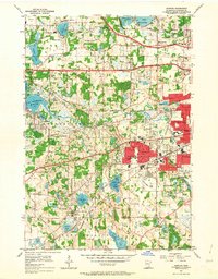
1954 Map of Hopkins
USGS Topo · Published 1956About this map
Hopkins and its surrounding suburban landscape appear here in the mid-1950s, a period defined by rapid residential expansion along the Great Northern and Chicago Milwaukee St Paul and Minneapolis rail corridors. The map documents significant institutional footprints including the Glen Lake Sanatorium and the Minneapolis Penal Institution, alongside the emerging neighborhoods of Golden Valley and St Louis Park. Specialized facilities like the County Boys Sch and the Shady Oak Sch (Abandoned) offer clear evidence of the area's shifting educational and social infrastructure.
Find a feature on this map
74 named features on this map. Tap any name to fly to it.
Don’t see what you’re looking for? This feature index may not catch every label — zoom into the map to look around manually.
Map Details
Editions of this 1954 Hopkins Map
2 editions found
Other maps of this area

1896 · Minneapolis
USGS Topo · 1:62,500

1901 · Minneapolis
USGS Topo · 1:62,500

1902 · Anoka
USGS Topo · 1:62,500

1905 · Minnetonka
USGS Topo · 1:62,500

1907 · Minnetonka
USGS Topo · 1:62,500

1909 · Rockford
USGS Topo · 1:62,500

1952 · Minneapolis North
USGS Topo · 1:24,000

1952 · Minneapolis South
USGS Topo · 1:24,000

1953 · Saint Paul
USGS Topo · 1:250,000

1953 · Stillwater
USGS Topo · 1:250,000